もらった絵文字56
写真28枚
04:327.7 km820 m

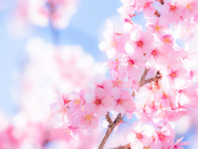
5月5日 ☀️ [唐沢山惨敗 https://yamap.com/activities/29775465 ]にDOMOが届いた🌸 DOMOが届くまですっかり忘れてた冬の課題😓 これは何かのお導き 行かねば🚶🏻♀️ 忘れてた冬の課題❄️ ご興味のある方はご覧ください🙇🏻♀️
土曜日は南信にてキャンプ、帰宅前に一山行こうと、未踏の雨引山をセレクト。 唐沢岳まではピンテはある&尾根なのでルートはわかるものの、急登で藪に近づきつつあります。 何より、地面やホールドがもろく、眺望もなく、まさにトレーニング(笑) 雨引山に登頂した頃はちょうど晴れてきて、良い感じでした。 通常と逆の時計周りで周回したので、下山も斜度きつめでした。 沢はとても綺麗、この辺りは釣りもできるのかな…
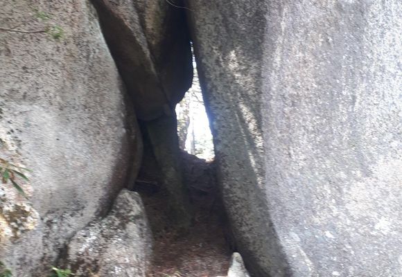
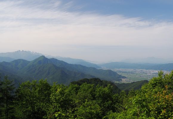
ジェームス作 陽子翻訳 English below... 私の番です! 雨引山と唐沢山は大町市と松川村の境にある。 私はふもとの登山者用の駐車場に車を停めた。 雨引山、唐沢山の山頂に行くのに二つのトレイルがある。一つは稜線を辿るコース(上の道)と谷から登っていく道(下の道)で、私はその両方を通ってみたかった。そこで、行きは上の道を通ることにした。 上の道は森を通って稜線に出、鎌倉岩を乗り越え、そのあと難所をロープを使って登り降りした。楽しく難所を通り越した後,雨引山の頂上に着いた。眺めは素晴らしかった。そこには、小さな神社、三角点マーカー、プラスチックのマーカー、札、鳥居があり、ランチブレイクに良い場所だった。 頂上ではほかの登山者たちがトレイルの整備作業をしている人たちと話をしていた。登山者が唐沢山のことを聞くと、整備作業員は、唐沢山へのトレイルはほとんど消えていて、斜面は急だし道に迷いやすいので登るのはやめたほうが良い、一年に一人か二人しか登らない山だと言っていた。それを聞いて私は「素晴らしい!私の出番だ!」と思った。 私は雨引山を下りて、上の道と下の道が出会うところまで来た。このポイントから西に行くと唐沢山だ。私は西へ向かった。低い笹は刈り込まれていて歩きやすかった。高圧電線の塔のあたりまでは楽な道だった。そのあとは低い笹を踏み分けて歩いた。そして急な登りになった。唐沢山の稜線はそこから頂上に至るまで、障害物の連続だった。障害物というのは、岩の塊だったり、木が密に生えていて迂回しなければならないところなどだ。障害物があっても頂上までリボンがつけられていたので、それを辿っていくことができた。 この場面での登りはとても急で、45度位あった。また、いくつかの場所では1メートルくらいの高さのところを木の根や枝をつかんで乗り越える所もあった。整備作業員の言っていたことは正しかった。 唐沢山の頂上では巨大な岩が二つ隣りあわせになっていてその隙間を通り抜けた。通り抜けた後、岩の一つに登り、そこが頂上だった。岩の上は積もった枯葉でふわふわしているので、歩くときに気を付けたほうが良い。そこからの眺めは素晴らしいものだった。そしてそこには山の頂上を表すものはなかった。 私は注意深く唐沢山を降り、下の道を使ってふもとまで降りた。 とても満足できる登りだった。 My turn! Amabikiyama (雨引山) (1371 meters / 4498 feet) and Karasawayama (唐沢山) (1575 meters / 5167.3 feet) are located on the border between Omachi city and Matsukawa village. I drove up to the area and parked in one of two parking lots that are dedicated for climbing. Then I started walking on the local road to reach the trailhead for the upper trail for Amabikiyama. Since there are two trails that lead to the summit (an upper trail and a lower trail) I wanted to try both. My choice was a good one, as the upper trail went through the forest and then onto a ridgeline that goes to Kumakura Rock. It’s a great climb, with a section in the middle for rope climbing up and down a difficult area on the trail. After a fun climb I reached the summit of Amabikiyama. The views are spectacular from the peak with a small shrine, a triangulation stone marker, plastic markers, signs and even a torii on the summit. It’s a great place to visit and have lunch. On the summit, other climbers were talking to trail maintenance workers who were trimming the brush on the trails. The climbers were asking about going to Karasawayama. A maintenance worker said that Karasawayama has hardly any trail to the top. It is very steep and easy to get lost, so you should maybe reconsider going there. Only about one or two people visit the summit each year. I thought to myself….Great! My turn! I walked down Amabikiyama to the junction point where the upper trail meets the lower trail, and then made my way west to the point where I needed to break off and climb Karasawayama. The beginning of the climb was easy, with the low bamboo trimmed down as I made my way under a high power transmission tower in the area, and continued to move up Karasawayama. As I went up, the trimmed trail turned into a faint trail through the low bamboo, which I followed and looked for ribbons in the area to guide me. Once I made it through the low bamboo, the real climbing began. The ridgeline for Karasawayama is topped with obstacles almost all the way to the summit. Obstacles meaning rock formations or clumps of trees so dense that you need to climb around them. Fortunately for me, colored ribbons marked the path clearly so that I knew exactly where to go to get around each obstacle on the ridgeline. The climb can be steep (45 degrees and higher at times) and you need to be able to pull yourself up the mountain more than one meter in many places, by grabbing onto trees and roots. I have to say that the maintenance worker was correct to warn people against climbing Karasawayama. It is not for your average climber. After a good workout, I finally came to the summit of Karasawayama…a huge set of rocks with an opening in the center. I climbed through the opening to get to the other side, and then made my way around to the left side of the rocks to climb on top. The ground on top of the rocks is made by fallen vegetation from the past, so you need to be careful where you step (it can be a little spongy). And the views from the summit were great. I could not find any signs or other markers to indicate the top of the mountain. After a short break, I carefully made my way back down Karasawayama, and then down the lower trail to the local road, and finally to the parking lot. A very rewarding day…
データを取得中です。取得には時間がかかることがあります。
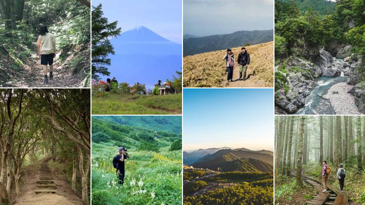
山歩(さんぽ)とは、山や身のまわりの自然の中を気持ちよく歩くこと。今すぐ行ける山歩コースや、山歩した気分になれる映像コンテンツを更新中です。