燕岳・餓鬼岳・唐沢岳(長野,岐阜,富山)
2025.09.28 (日)日帰り
ホントは、5月に見頃を迎える
ヤマツツジ彩る登城道が素敵な
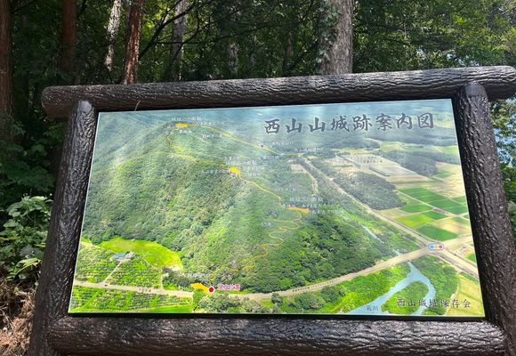
西山城址🏯🌳🌺🐾🌸🌿🌳🕊️
この時季は見どころないです…😅
山ぐりとどんぐり🌰
きのこが少々🍄🟫🍄
が、しかぁ〜し
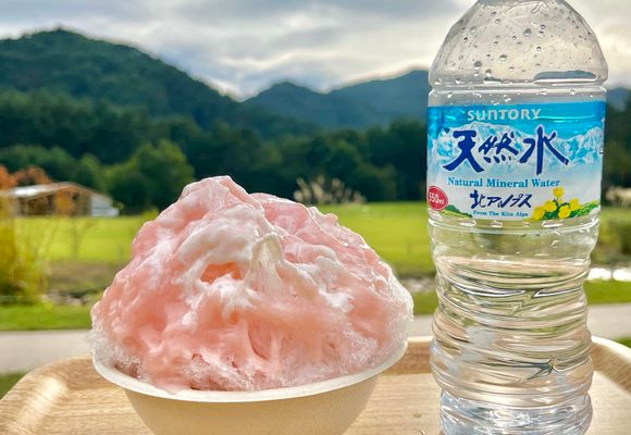
麓の サントリー天然水💧
北アルプス 信濃の森工場の🌳🌳
みずのわカフェ
夏季限定 天然水のかき氷🍧
今日が最終日と聞きつけ
こりゃ行かねば!
と、慌てて準備する わたし🤣
ついでに、破線ルートの尾根を辿って
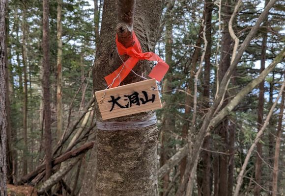
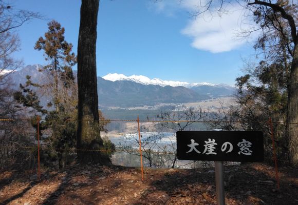
大洞山⛰️まで足を延ばしたら
営業時間内にたどり着けるか?💦
麓の 西山八王子神社⛩️で、参拝
熊さん🧸に、出会いませんように🙏
それでは、周回スタート!
熊さん対策なのか?
それとも文化財の補助金がついたのか?
何しろ綺麗に整備されている🤩
見通し良すぎて
こりゃ〜 熊さんと鉢合わせする心配は
無さそうです😆
西山城址保存会のみなさんに感謝🙏
そして、下山後のお楽しみ
"おつかれ山" は、麓のカフェで🍧😋
💧0.5㍑ → 残0.0㍑
サントリー天然水 北アルプス0.5㍑
登り0.1
ランチ0.2
下り0.2
🥖
カフェオレクリームパン🥖.ファミチキ🍗
🚗
🪧朝日登り口
県道496(あづみの公園大町線)
→県道306(有明大町線)
🅿️
西山城址駐車場(朝日登り口)🆓 6台
トイレ無し
https://www.city.omachi.nagano.jp/00025000/00025900/3omachi-yamajoro.html
西山八王子神社駐車場🆓 20台
境内トイレ🆓
🍧
サントリー天然水 北アルプス信濃の森工場
みずのわカフェ
9:30~16:15 土日祝日のみ
北アルプス天然水のかき氷
信州産白桃ヨーグルト練乳@850
https://www.suntory.co.jp/factory/kitaalps/map/#