It's been the best part of 10-years since I last hiked this course and, with my 67-yearold memory not what it use to be, I had to treat this hike with caution. Since then there have been many storms & typhoons that have left their mark, so I needed to take that into consideration. The first section wasn't well signposted and maintained, and, on a few occasions, I lost my way. I was relieved when I finally arrived at Ten-jinja. The next section was the opposite - very-well signposted and maintained - giving me the impression that this was a popular track. Passing-through the tea plantation and onto the next section, again well signposted and maintained. The final section, again I wondered off course a couple-of-times, as can be seen on the map, and I was relieved when I finally emerged at Ujitawara-cho. For the mountain-bikers amongst us, there is some great track here to explore. For the hiker, if you are a beginner, I would suggest someone with experience accompany you.
J.R. Kamikoma Station, and the start of another marathon hike.
J.R. Kamikoma Station, and the start of another marathon hike.
Steps, entrance to the Tenjikudo Ruins.
Steps, entrance to the Tenjikudo Ruins.
Not fully up-to-date with the history surrounding this site -
Not fully up-to-date with the history surrounding this site -
- but I believe there was once a Temple on this site.
- but I believe there was once a Temple on this site.
About to leave civilization behind and enter the forest.
About to leave civilization behind and enter the forest.
Some more religious icons -
Some more religious icons -
- possibly attached to the Tenjikudo Ruins.
- possibly attached to the Tenjikudo Ruins.
I wandered a bit off course and had to find a way to get back on track.
I wandered a bit off course and had to find a way to get back on track.
Signage, notifying the entrance to the Higashiyama-jo site.
Signage, notifying the entrance to the Higashiyama-jo site.
The next three images on the site of Higashiyama-jo.
The next three images on the site of Higashiyama-jo.
Time to pause.
Time to pause.
Some signage directing the hiker to their next destination.
Some signage directing the hiker to their next destination.
At the settlement of Jindoji and a Torii, denoting the entrance to Ten-jinja.
At the settlement of Jindoji and a Torii, denoting the entrance to Ten-jinja.
Ten-jinja.
Ten-jinja.
About to exit the settlement and re-enter the forest.
About to exit the settlement and re-enter the forest.
This section of my course was well signposted and maintained.
This section of my course was well signposted and maintained.
Notice informing the entrance to Tobiga-jo.
Notice informing the entrance to Tobiga-jo.
A great view overlooking Kamo-cho.
A great view overlooking Kamo-cho.
Signage giving details of the castle.
Signage giving details of the castle.
Foundation wall, not the original.
Foundation wall, not the original.
The main castle site.
The main castle site.
Three-way junction. To the right, the track descends to Kuni-jinja. Straight ahead, my next destination.
Three-way junction. To the right, the track descends to Kuni-jinja. Straight ahead, my next destination.
Junction. To the right, the track descends to Kaijusen-ji. To the left, to my next destination - the Yamashiro Forest Park.
Junction. To the right, the track descends to Kaijusen-ji. To the left, to my next destination - the Yamashiro Forest Park.
Time for another pose.
Time for another pose.
Looking back up to where I just descended from.
Looking back up to where I just descended from.
Looking back down to the river.
Looking back down to the river.
At this point, I reached a landslide blocking-off the track. So some kind person tied this rope to a tree so hikers could descend down to the river.
At this point, I reached a landslide blocking-off the track. So some kind person tied this rope to a tree so hikers could descend down to the river.
It was very steep and great care was needed.
It was very steep and great care was needed.
The last time I came here, there was a bridge here.
The last time I came here, there was a bridge here.
Exiting the forest to emerge -
Exiting the forest to emerge -
- at a tea plantation -
- at a tea plantation -
- and a well deserved lunchbreak. As this area was exposed, and there was a cold wind blowing, I didn't stay here for long.
- and a well deserved lunchbreak. As this area was exposed, and there was a cold wind blowing, I didn't stay here for long.
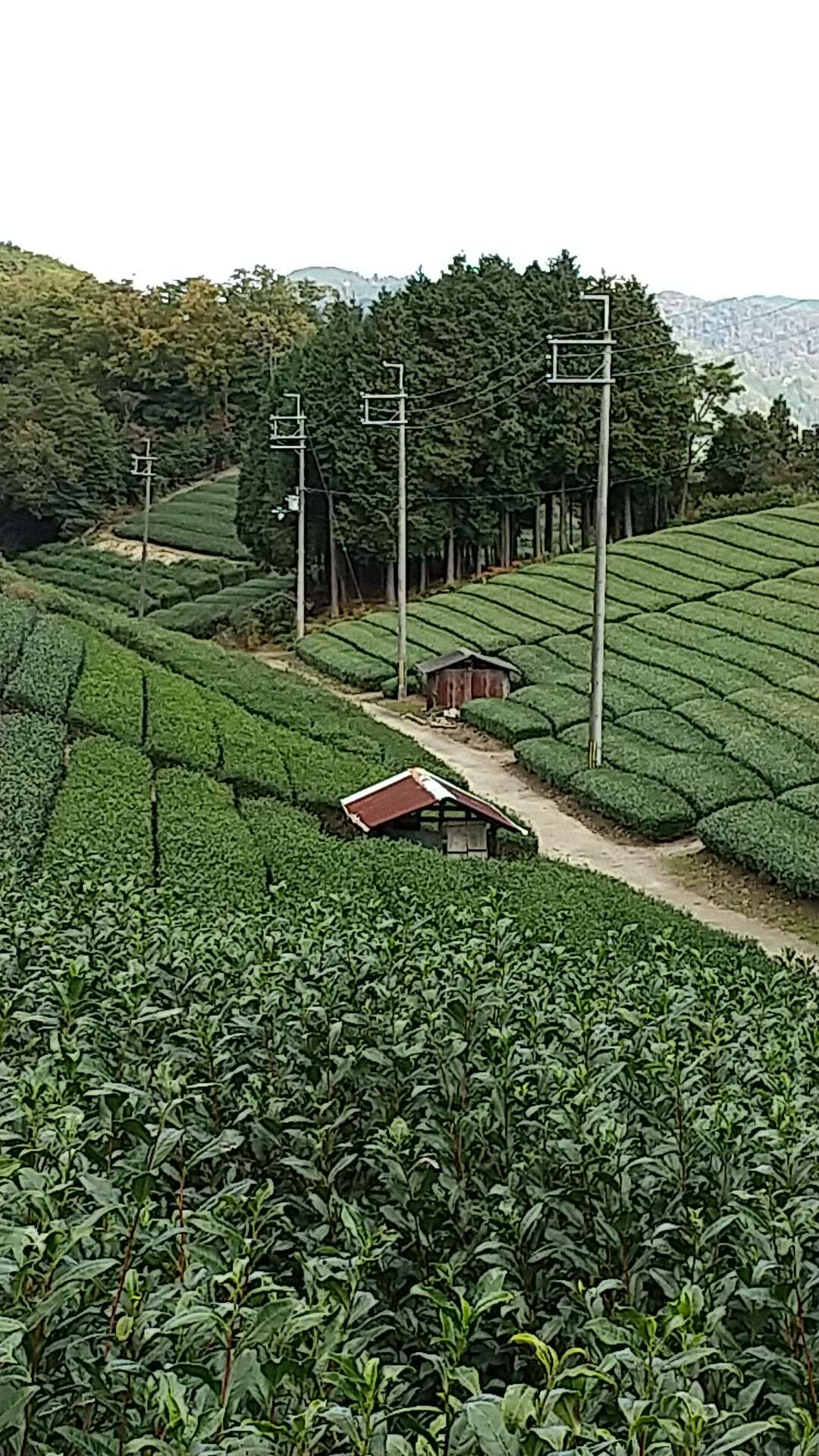
More tea plantations.
More tea plantations.
Junction. To the right the track emerges onto route-62. The track to the left, to where I am heading.
Junction. To the right the track emerges onto route-62. The track to the left, to where I am heading.
The track is well signposted and maintained.
The track is well signposted and maintained.
Time for another meal break.
Time for another meal break.
This section was one hell of a steep climb.
This section was one hell of a steep climb.
Junction, and my next destination.
Junction, and my next destination.
Power-pylon, and a good view overlooking Ujitawara.
Power-pylon, and a good view overlooking Ujitawara.
Summit of Gonzan.
Summit of Gonzan.
About to emerge at Ujitawara and the today's goal.
About to emerge at Ujitawara and the today's goal.
My goal - I was so pleased to reach this point as, at one stage, I thought I wouldn't make it.
My goal - I was so pleased to reach this point as, at one stage, I thought I wouldn't make it.
J.R. Kamikoma Station, and the start of another marathon hike.
Steps, entrance to the Tenjikudo Ruins.
Not fully up-to-date with the history surrounding this site -
- but I believe there was once a Temple on this site.
About to leave civilization behind and enter the forest.
Some more religious icons -
- possibly attached to the Tenjikudo Ruins.
I wandered a bit off course and had to find a way to get back on track.
Signage, notifying the entrance to the Higashiyama-jo site.
The next three images on the site of Higashiyama-jo.
Time to pause.
Some signage directing the hiker to their next destination.
At the settlement of Jindoji and a Torii, denoting the entrance to Ten-jinja.
Ten-jinja.
About to exit the settlement and re-enter the forest.
This section of my course was well signposted and maintained.
Notice informing the entrance to Tobiga-jo.
A great view overlooking Kamo-cho.
Signage giving details of the castle.
Foundation wall, not the original.
The main castle site.
Three-way junction. To the right, the track descends to Kuni-jinja. Straight ahead, my next destination.
Junction. To the right, the track descends to Kaijusen-ji. To the left, to my next destination - the Yamashiro Forest Park.
Time for another pose.
Looking back up to where I just descended from.
Looking back down to the river.
At this point, I reached a landslide blocking-off the track. So some kind person tied this rope to a tree so hikers could descend down to the river.
It was very steep and great care was needed.
The last time I came here, there was a bridge here.
Exiting the forest to emerge -
- at a tea plantation -
- and a well deserved lunchbreak. As this area was exposed, and there was a cold wind blowing, I didn't stay here for long.
More tea plantations.
Junction. To the right the track emerges onto route-62. The track to the left, to where I am heading.
The track is well signposted and maintained.
Time for another meal break.
This section was one hell of a steep climb.
Junction, and my next destination.
Power-pylon, and a good view overlooking Ujitawara.
Summit of Gonzan.
About to emerge at Ujitawara and the today's goal.
My goal - I was so pleased to reach this point as, at one stage, I thought I wouldn't make it.