活動データ
タイム
01:10
距離
2.5km
のぼり
328m
くだり
330m
チェックポイント
活動詳細
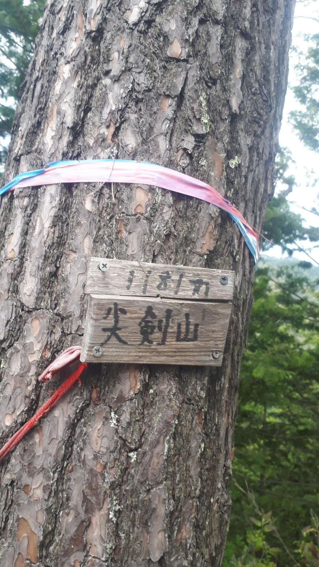
すべて見るジェームス作 陽子翻訳 English below... 尖剣山は塩尻市の北西にある。それはあまり人が登ることのない山だ。 私はヤマップのメンバーが残した記録から、登り始める位置を知り、そこの近くの道に車を停めた。 そして赤いリボンのところから森に入った。歩いて行くうちにトレイルは次第にわかりにくくなっていった。そしていつしか完全に道の痕跡が消えた。これは枯葉が積もっていたためだった。トレイルを探そうとしたが、無理だとわかり、北にある高圧電線タワーを目指して歩いた タワーからはトレイルがはっきりわかるようになった。私は稜線を途中まで登り、横に移動して、違う稜線に行き、それを登って頂上に着いた。 頂上には、プラスチックの杭、木につけた札があり、眺望はなかった。帰りも途中で道が消えたが、迷わずに下山できた。 この山に登る人は迷わないように注意しなくてはいけない。 A lonely peak in Shiojiri city… Senkenzan (尖剣山) (1181 meters / 3874.7 feet) is located in northwest Shiojiri city. It’s a peak climbed by very few people. I drove up to the indicated starting point from another YAMAP member, and parked the car along the road. I then entered the forest at the indicated area marked by red ribbons. The trail was very hard to read as I climbed up into the forest. As I continued climbing up, the trail became impossible to follow. This was due to the amount of fallen tree debris on the forest floor. After looking at the intended path up the mountain, I decided just to simply climb up the side of the hill until I found the trail in the forest that runs north toward the high-power transmission tower on the map. Once I reached the tower, the trail became very clear. I followed one ridgeline, and then moved across the hillside to another ridgeline that went to the summit. On the summit, I found a plastic stake in the ground, a small sign on the tree and no clear views. After a quick snack, I made my way back down and tried to follow the trail that I could not find on the way up. Once again, I lost the trail and simply made my way down the hillside, until I found the trailhead. Take care when climbing this peak…
もしも不適切なコンテンツをお見かけした場合はお知らせください。