活動データ
タイム
03:43
距離
9.1km
のぼり
939m
くだり
918m
活動詳細
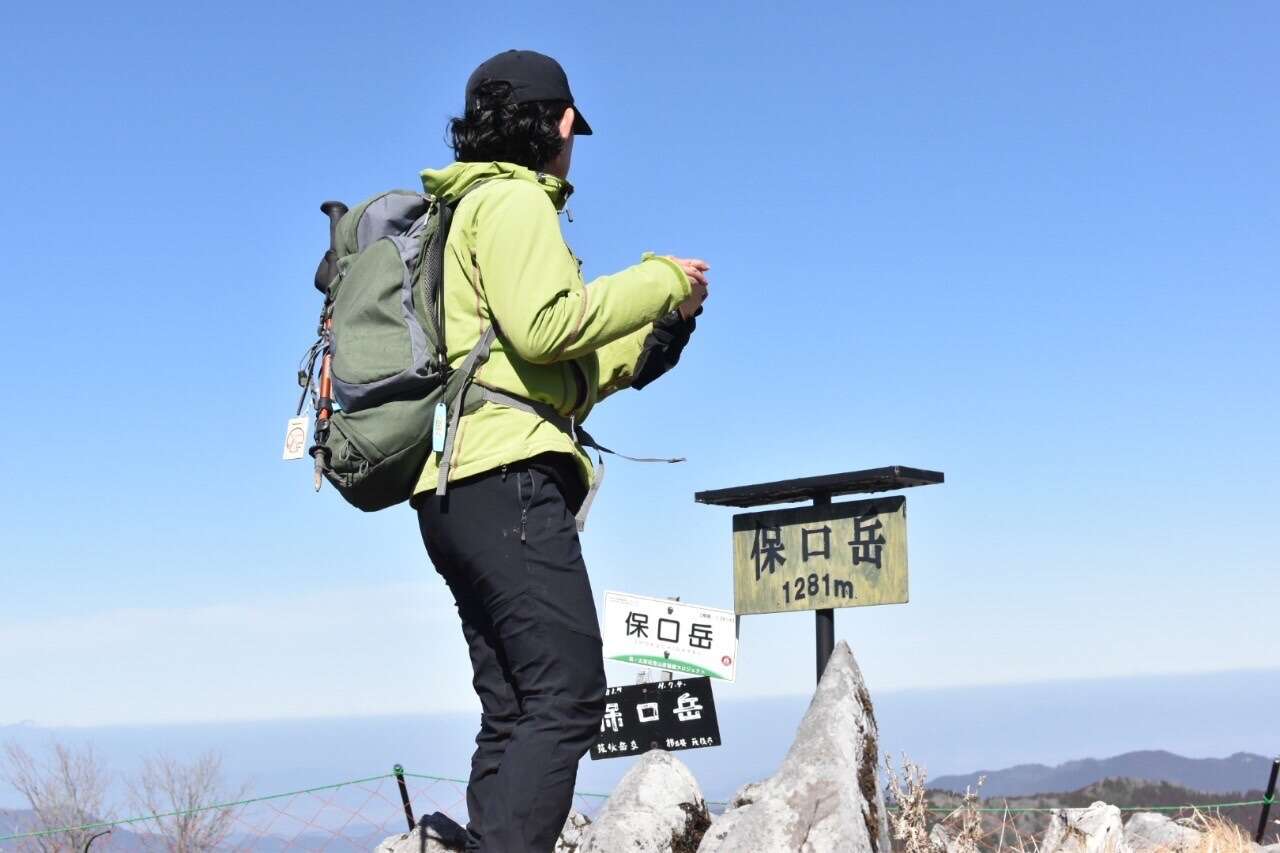
すべて見る九州100名山、熊本県内の山は、今日でコンプリート😆 最後の保口岳を、かめ様のおかげで今日無事に終えることができました。 行きは、数々の通行止めで迂回に迂回を重ね、五家荘トンネルから坂木川に沿って上がっていきました。3時間半以上かかってようやく登山口手前まで辿り着きましたが、念のためほかの方々のレコを参考にしつつ1.6km手前に駐めて歩きました(ちょっとジャリ区間ありますが普通車で登山口まで行けます)。 登山道はまったく危険個所なく歩けますが、帰りの林道は崩壊箇所が数か所あり、かなりヤバい状態になりつつあります。数年以内には通行不可能になるかもしれません・・・🥲 スズタケの藪こぎが中腰歩きで結構きつかったけど、普賢峰は岩場が楽しく、保口岳山頂は360度絶景で、とても良き山々でした。この山はとにかくアクセスが一番しんどい!登山口に着いたらもう登山は半分終えたと思って良いでしょうww 帰りは、軽トラに乗ったイケメンのおじちゃんに教わって、三本木峠の方へ上がり、八代農業の泉分校を通って219号線へ。こちらもなかなかのアドベンチャー車道でしたが基本舗装路で、イケメンのおじちゃんが先導してくれたおかげで、とっても助かりました。おじちゃんに大感謝です。 ★247号線は途中から通行止めになります❎ ★登山口まで、とにかく気を抜けない細い道、所々砂利道になったり抉れていたり、落石も多数。 ★登山道は危険個所なし、林道は危険いっぱい。 Among the 100 famous mountains in Kyushu, all mountains in Kumamoto Prefecture have been complete today! Thanks to Kame-san, I was able to finish the last Hoguchidake today. On the way to go, we went up along the Sakaki River from the Gokanoshō tunnel. There were many detours and detours. It took more than three and a half hours to finally reach the front of the trail head. Just in case, we parked 1.6km before the trail head referring to other people's records (there is a little bumpy section, but you can reach the trail head by normal car). We were able to walk on the mountain trail without any danger, but the forest road on the way back has several collapsed points, which were quite dangerous. It may become impassable within a few years ... The bushes of Suzutake were pretty hard walking around, but the summit of Mt. Hoguchi had a 360-degree view. This mountain is the hardest to access anyway! When you reach the trail head, you can think that the mountain climbing is half done, LoL. On the way back to home, we met a handsome guy who told us to go through Sanbongi Pass, via the Izumi branch of Yatsushiro Agriculture high school. We were able to reach Route 219 in a shorter time thanks to this handsome guy. This was also quite an adventure road, but all paved basically. ★ Route 247 is closed ❎ ★ There are many narrow roads, with many rockfalls up to the trailhead. ★ There are no dangerous spots on mountain trails, but the forest roads are full of danger.
もしも不適切なコンテンツをお見かけした場合はお知らせください。