活動データ
タイム
09:38
距離
18.0km
のぼり
2045m
くだり
1965m
活動詳細
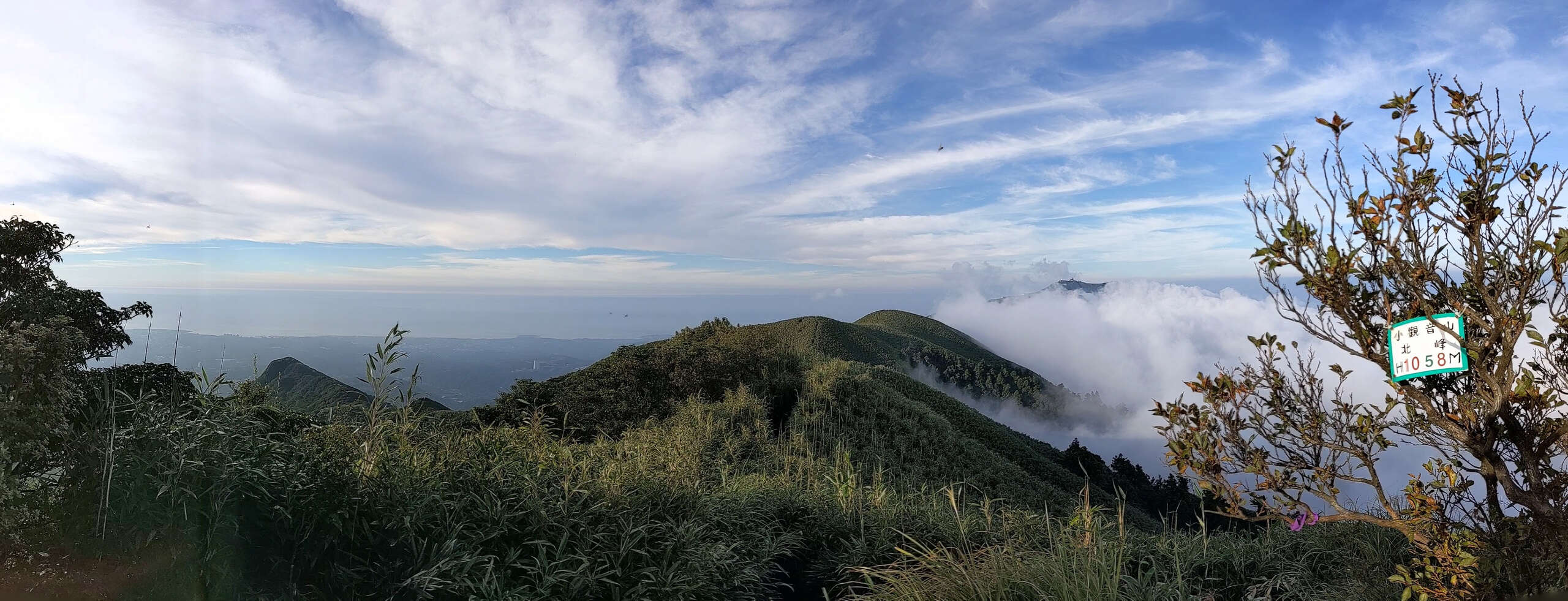
すべて見るI solo-ed hiking the 小觀音山 loop for the first time. It's partly cloudy, RH was about 70~75%. The loop I hiked: 大屯山鞍部停車場↗西峰~西西峰↘大屯溪↗北峰~主峰~戰備道 Along the loop, I could see the largest volcanic crater in Taiwan. It's very beautiful. Between 西西峰~大屯溪, I experienced a super steep incline. And It took me 2 hours to go down this 1 km section because it's super slippery! It rained 3 days ago, but it was still muddy and slippery. And there were not too much I could grab except for those bamboos. And between 大屯溪~北峰, it's again a super steep incline to go uphill, but it's much better since it was almost dry. Finally, on the 北峰, I happened to see the cloud sea, it's awesome but unfortunately I didn't have too much time to take landscape pictures. === For your information === 小觀音山: - the largest volcanic crater (火山口) in Taiwan - all the trails are maintained by mountaineers - a mountain in clouds 小觀音山 popular trail: - V形: 登山口~西西峰~戰備道~主峰~北峰 - go back to 戰備道 after reaching 西西峰, not going down to 大屯溪 - good for taking photos - popular for mountaineers 小觀音山 loop trail: - O形: 登山口~西西峰~大屯溪~北峰~主峰 - 4+ hours - DO NOT COME at bad weathers, very very easy to get lost - ONLY COME on sunny days (and perhaps weekends for safety) Began from: - 清天宮 - Taipei City bus S6 (小6) from 北投站 Ended at: - 陽明山国家公園遊客中心 - Taipei City bus S9 (小9) to 北投站 Toilets: - 0.0km 清天宮 (public toilet) - 4.7km 二子坪遊客中心 - 13.2km 小油坑遊客中心 (水、売店は 0900~1630) - 18.1km 陽明山國家公園遊客中心 (水は 0900~1630) === Trail status === 小觀音山: - dirt road, muddy - narrow 小觀音山西西峰~大屯溪: - very steep incline - super slippery - there are ropes to grab in some sections 大屯溪~小觀音山北峰: - steep incline - there are ropes to grab in only a few sections 戰備道〜: - cement concrete road 〜七星山小油坑登山口: - tarred road - highway その他: - stone steps
もしも不適切なコンテンツをお見かけした場合はお知らせください。